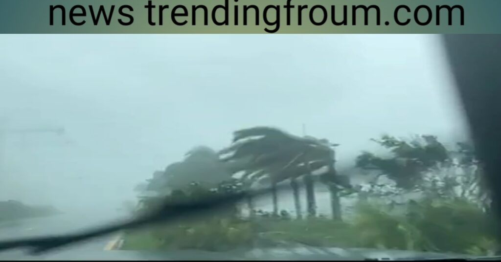
Florida Gov. Ron DeSantis provided an early morning update Wednesday on the path of the hurricane.
Hurricane Ian strengthened into a Category 4 storm early Wednesday morning just hours before it made landfall in Florida. It weakened to a Category 3 hurricane at approximately 7:30 p.m and then to a Category 2 later that evening.
Florida residents are bracing for heavy rain and winds, with Ian packing winds up to 155 mph as of 6:35 a.m., according to Weather.com. A tornado watch is in effect for central and southern Florida until 5 p.m.
HURRICANE IAN ‘NEAR WORST-CASE SCENARIO’
Residents in Florida and Cuba have been bracing for possibly “life-threatening” conditions as sea levels continue to rise and winds reaching 125 mph push water to the shores.
The Cuban provinces of Isla de la Juventud, Pinar del Rio, and Artemisa issued hurricane warnings, as did cities along the west coast of Florida from Englewood to the Anclote River.
Several Florida cities also issued evacuation orders ahead of the storm on Monday, with flooding greater than 9 feet expected over the coming days.
Florida Gov. Ron DeSantis (R) declared a statewide state of emergency on Saturday in preparation for the storm.

Hurricane Ian downgraded to Category 2 Brady Knox
Hurricane Ian has been downgraded to a Category 2 as the storm wreaks havoc across central Florida.Wind speeds have slowed from 150 mph when the storm made landfall to 105 mph currently, according to WESH.
Despite being downgraded two levels since its original landfall on Wednesday afternoon, the National Weather Service still warns Floridians that conditions will “deteriorate overnight.””Conditions will deteriorate tonight. TS to hurricane force winds are expected.
The threat of significant to catastrophic flooding is expected to develop tonight-Thu for areas from N Osceola & N Brevard north including metro Orlando. Flooding can be especially dangerous at night,” the weather service tweeted.
Hurricane Ian downgraded to Category 3
Hurricane Ian was downgraded to a Category 3 hurricane Wednesday night, hours after making landfall near Fort Myers, Florida.
The highest wind gust measured at 132 mph near Port Charlotte, and maximum sustained winds are currently at 125 mph, according to a National Hurricane Center advisory.
When it made landfall Wednesday afternoon, the storm had a high wind gust of 150 mph, making it a Category 4 hurricane.Although the strength of the storm has weakened slightly, Ian is still causing significant damage as a devastating storm.
Hurricane Ian tracker live: Landfall made in Cayo Costa as Category 4 storm smashes
Florida Gov. Ron DeSantis provided an early morning update Wednesday on the path of the hurricane.Hurricane Ian strengthened into a Category 4 storm early Wednesday morning just hours before it made landfall in Florida.
It weakened to a Category 3 hurricane at approximately 7:30 p.m and then to a Category 2 later that evening.Florida residents are bracing for heavy rain and winds, with Ian packing winds up to 155 mph as of 6:35 a.m., according to Weather.com. A tornado watch is in effect for central and southern Florida until 5 p.m.
Hurricane Ian video In Florida
Hurricane Ian made landfall in southwestern Florida near Cayo Costa as a massive Category 4 storm on Wednesday afternoon, lashing the state with heavy rain and pushing a devastating storm surge.
The video shows an alligator about 9 or 10 feet long in the high water in Astor.Video from a neighborhood and backyard canal shows strong winds and rising water in Orlando Wednesday.
An aerial view of damages in Broward County, Florida, ahead of Ian’s landfall.Tampa Bay, Florida Water recedes from Tampa Bay as Hurricane Ian approaches Florida.A hurricane hunter that goes by Tropical Nick Underwood shared a video with sisters station WESH that shows a rough ride into Hurricane Ian.
This video from Naples Fire Rescue shows a water rescue during flooding caused by Hurricane Ian.Other videos showed power lines bursting into flames as Hurricane Ian moves through.
Read Also:

